K Fellfarers - the outdoor club for people in south Cumbria
Gallery 2013 - April
High pressure continued over the British Isles during Easter week at the start of April, giving cold and usually clear days. The Wednesday of Easter week was exceptionally bright and these photos are of a walk up Grisedale to Grisedale Tarn and back over Seat Sandal. Right: the view from Seat Sandal towards Fairfield and St. Sunday Below left: patterns on the frozen tarn Below right: the tarn with Seat Sandal as a back drop |
.jpg) |
.jpg) |
.jpg) |
The fine and cold weather continued into the second week of the month, causing the snow to linger, especially on the north and eastern slopes.
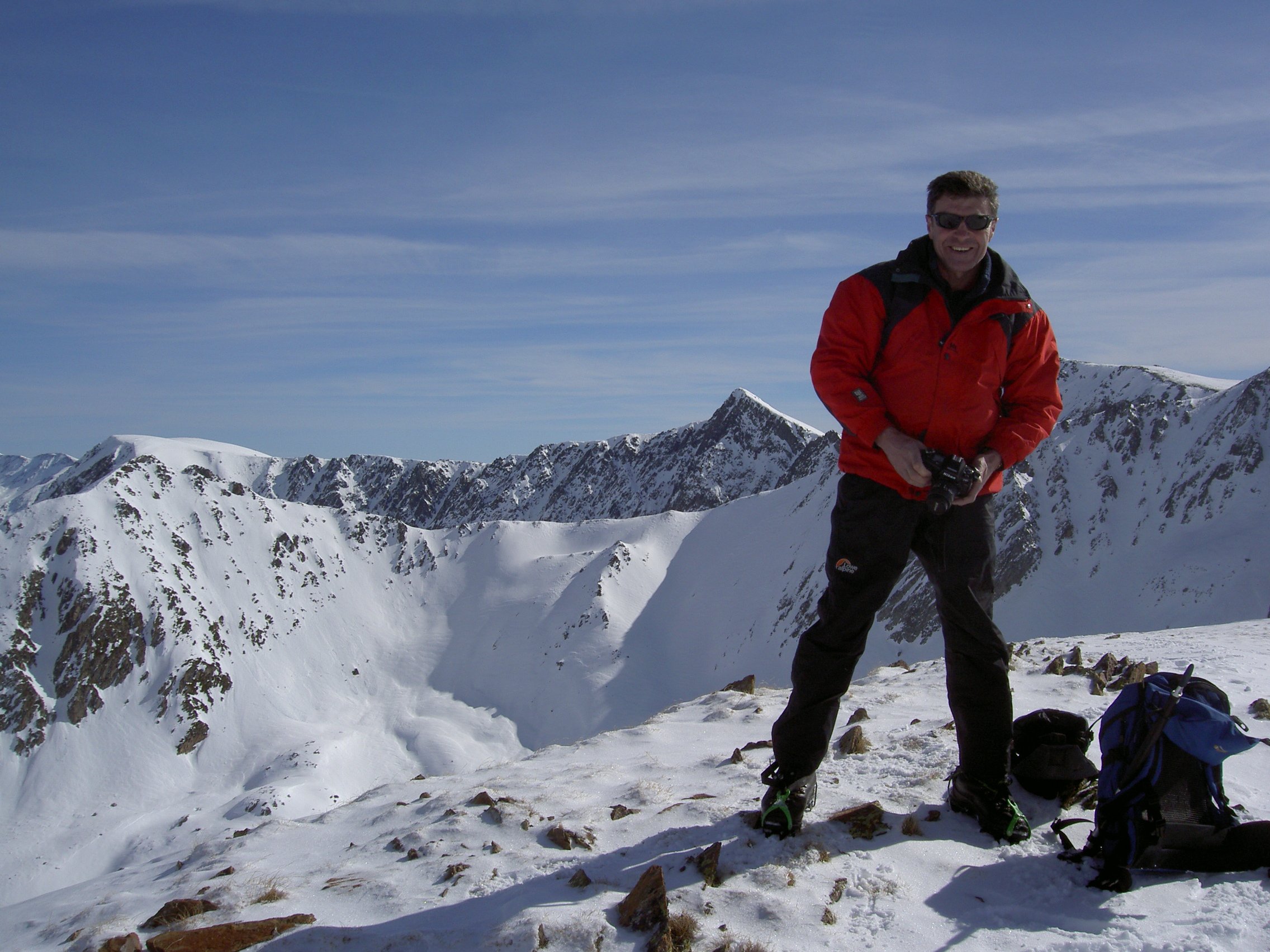
Right is Hugh on Pike O'Stickle Below left is the approach to Harrison Stickle from Pike O'Stickle. Below right the view of Stickle Tarn from the summit. |
.jpg) |
|
.jpg) |
Mid Week Walk - not the Dove Crag circular from Brothers Water. |
|
| Six members and three guests met at Brothers Water, and watched the rain sweeping down. With the milder weather came the rain, and the snow soon dissapeared. With a poor forecast in mind, the correct decision was made to have coffee at Wilfs. Four then left for home, leaving five to walk via Hagg Wood with its daffodils and wood anemones, to Mikes Wood above Spring Hag for lunch. Then back via the delightful Elf Howe cottages and Scroggs Farm. Not the walk we intended but delightful nevertheless, and we didn't even get wet! The photo on the right shows the lovely lane on the approach to Middle and Low Elfhowe from Hall Lane. |
.jpg) |
Thack Moor joins the list of 2,000 foot tops in England |
|
Thack Moor is above the village on Renwick just west of Hartside. Being just below the magic 2,000 foot mark, it has been re-measured and an extra 3/4 inch has been 'found' to push it over the minimum. For the full story, see a copy of an article here. The hill is an easy one hour walk from Renwick. Park at the end of the yellow road heading up the fell from the village, and walk up the lane towards the hill - below left. The lane peters out at an old mine working (trial?) and a vague path continues up the steepening and onto the summit plateau, where the trig point will be seen nestling against the wall - below right, with Cross Fell in the distance above the trig point. Return by the same route, or for a change head south east for half a mile, and then due south across the moor to join up with a lane coming off Renwick Fell. |
|
.jpg) |
.jpg) |
|
|
|
|
| ©2007 Wizard Wheeze Promotions | |
.jpg)